
Solihull's final draft Local Plan needs 1,289 homes a year, 58% more than in 2020, with 8,219 near railway stations. Cabinet decides on 29 September.
Solihull Council has published the Local Plan it intends to send for independent examination. It plans for 21,913 new homes between 2026 and 2043, and says it has found land for 23,091.
The biggest single source is land near railway stations, much of it in the Green Belt. The draft expects 8,219 homes to come from it.
Cabinet will discuss the plan on Tuesday 29 September. It is being asked to endorse it and to recommend that Full Council approves it for publication on Tuesday 6 October. (Solihull Council, 23 September 2026)
Why the number went up
The plan’s housing target is set by the government’s standard method. For Solihull it now works out at 1,289 homes a year.
The 2020 draft plan, which was later withdrawn, planned for 816 a year. The new figure is 473 a year higher, a rise of 58%. Over the 17-year plan period, that adds around 8,000 homes. (Draft Submission Plan, paragraph 104)
It is also about double what the borough has actually been building. Completions over the last ten years ranged from 287 to 828 a year. The average was 647.
The method uses Solihull’s housing stock of 96,333 homes and how expensive homes are compared with local wages. The plan puts the median house price at £330,000 and median workplace earnings at £42,587.
Where the homes would go
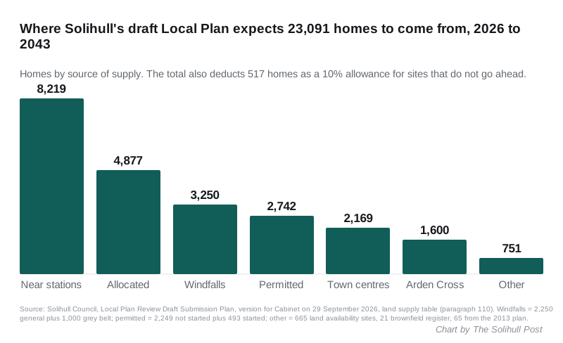
The plan’s land supply table breaks down like this:
- 8,219 on land around railway stations
- 4,877 on sites allocated in the plan
- 2,250 from small “windfall” sites that come forward each year from 2028
- 2,249 on sites with planning permission that have not started, plus 493 already under way
- 2,169 in the town centres: 1,600 at Mell Square (to be called Holbeche Place) and 469 at Eastgate in Solihull, and about 100 in Chelmsley Wood
- 1,600 at Arden Cross, next to the HS2 Interchange site
- 1,000 from “grey belt” planning applications decided before the plan is adopted
- 751 from other identified sites
A 10% allowance of 517 homes is then taken off for permitted and identified sites that may never be built. That leaves a surplus of 1,178 homes, or 5.4%, over the 21,913 needed. (Draft Submission Plan, paragraphs 110 to 143)
Homes near stations
The August 2026 National Planning Policy Framework says some building near well-connected stations is “not inappropriate” in the Green Belt. It defines a reasonable walking distance as 800 metres.
Solihull has assessed land within 1,000 metres of each station. It left out land that is already built on, parks, ancient woodland and flood zones. Anything between 800 and 1,000 metres would still need “very special circumstances”.
The draft names these stations as “broad locations” for growth:
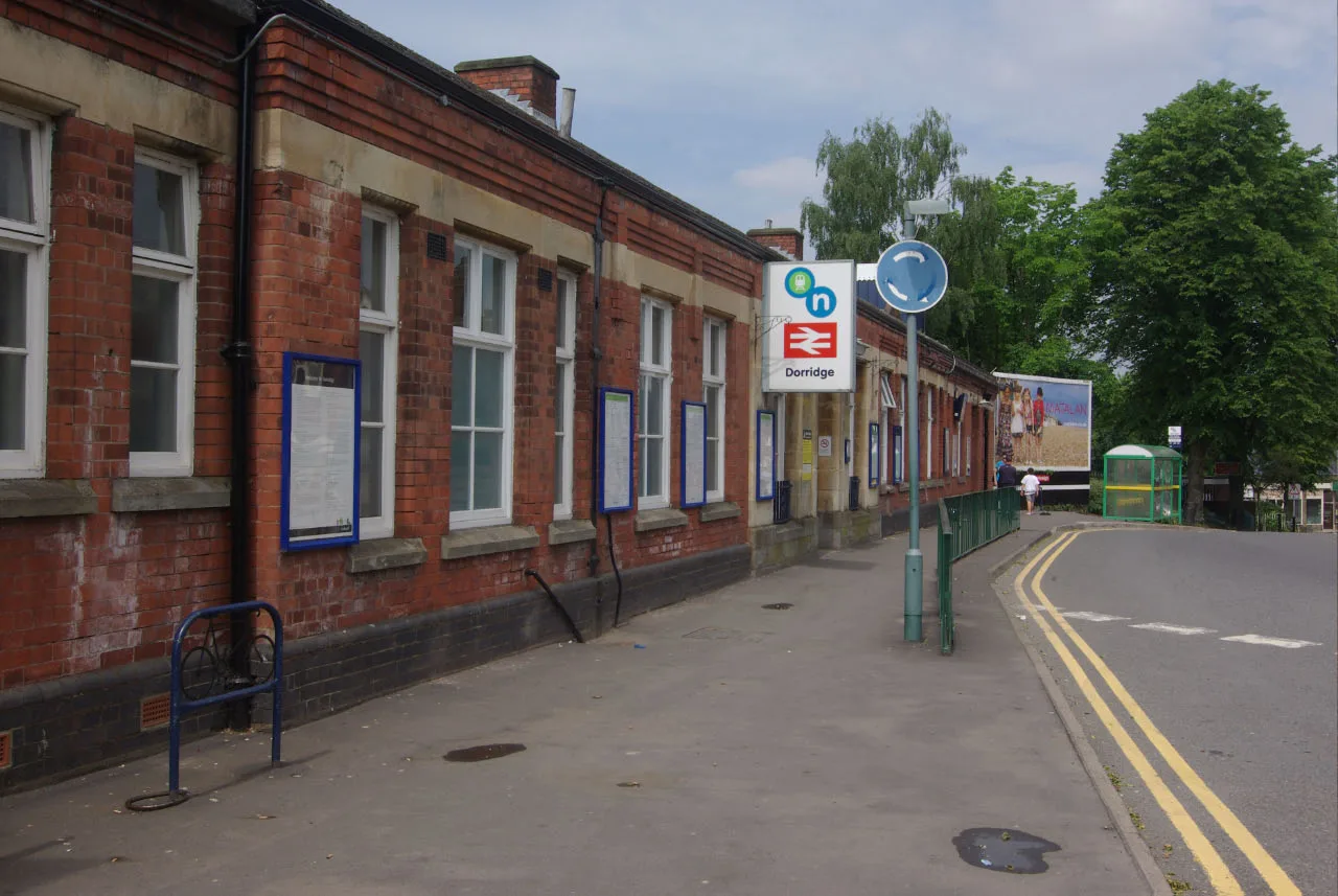
- Dorridge
- Hampton in Arden
- Berkswell
- Whitlock’s End, grouped with Wythall and Earlswood stations
- Tile Hill, which is in Coventry but close enough for Solihull land to be within walking distance
These are not site allocations. The plan says the exact scale and layout would be settled through planning applications, neighbourhood plans or a later supplementary plan. The table that would give each station’s share is still marked “to be confirmed” in the version going to Cabinet.
The named sites
Sites allocated in the draft include:
| Site | Homes |
|---|---|
| East of Solihull | 700 |
| South West of Dickens Heath | 450 |
| Whitlock’s End Farm | 450 |
| Trevallion Stud, Balsall Common | 310 |
| Windmill Lane/Kenilworth Road, Balsall Common | 120 |
| Land North of Hampton Road, Knowle | 114 |
| Meriden Road, Hampton in Arden | 100 |
| Lavender Hall Farm, Balsall Common | 90 |
| Moat Lane Depot | 90 |
| Hallmeadow Road/Riddings Hill, Balsall Common | 65 |
| Land South of Hampton Road, Knowle | 58 |
Source: Draft Submission Plan, settlement chapters. The plan’s own summary table of allocations is also still marked “to be confirmed”, so this list is taken from the individual site policies.
Balsall Common also has four broad locations. They include about 400 homes on the HS2 depot land west of Lavender Hall Lane, in the later years of the plan.
Affordable homes
The draft asks for 50% affordable housing on major sites in or released from the Green Belt. Other major sites, of 10 or more homes, would need 40%.
The council’s housing needs assessment found a need for 714 affordable homes a year.
Why the rush
Under the old plan-making system, a plan has to be submitted for examination by 31 December 2026.
The Cabinet report says the housing minister wrote to the council in December 2025, disappointed that it was not using that route. The council then switched to it. The report points to Tonbridge and Malling, which was directed by the government on 4 September 2026 to publish its plan and submit it by the same deadline. (Cabinet report, 29 September 2026)
The borough’s current plan dates from 2013 and is described in the report as “largely out of date”. Until a new one is adopted, the report says, the council is “more vulnerable to speculative and uncoordinated planning proposals”. About 20 major applications on Green Belt land, covering more than 4,000 homes, were awaiting a decision when the plan was drafted.
Councillor Andrew Mackiewicz, Cabinet member for climate change and planning, said the plan “seeks to protect the features that make Solihull a special place to live, such as the Green Belt and Meriden Gap; whilst meeting Government targets and providing homes and jobs suitable for all”.
What happens next
- 29 September: the Economic Development and Managed Growth Scrutiny Board looks at the plan, then Cabinet meets.
- 6 October: Full Council decides whether to publish it.
- By the end of October: the plan is published for six weeks of comments.
- By 31 December: the plan goes to the government for examination by a planning inspector.
- Around the end of 2027 or early 2028: the plan expects to be adopted, if the inspector finds it sound.
The report budgets £430,000 in 2025/26, £250,000 in 2026/27 and £300,000 in 2027/28 for the work.
What it means for you
- This is the last main chance to comment. Once the six weeks open, comments have to be about whether the plan is “sound” and legally compliant, not simply whether you like it. Point to the policy or paragraph you mean and say what change would fix it.
- Live near Dorridge, Hampton in Arden, Berkswell or Whitlock’s End stations? Land within walking distance of these stations is the plan’s biggest source of new homes, 8,219 across all of them. There is no station-by-station figure yet.
- Planning applications near you will not be judged against this plan for a while. The report says it is unlikely to carry much weight until at least the examination stage.
We track decisions and new applications on our Solihull planning news page. Our earlier report on the council’s Green Belt study and possible grey belt land explains how the grey belt rules work.
Sources: Solihull Council news release, 23 September 2026; Cabinet report, Publication and Submission of the Draft Submission Local Plan; Appendix A, Draft Submission Plan (version for Cabinet).
Have your say